Deputy Leader of Turkey's 6th National Antarctic Science Expedition Hasan Hakan Yavaşoğlu said that HAVELSAN GNSS, the Global Positioning System receiver developed by HAVELSAN for ships and naval platforms, was successfully used in polar research.
Regarding HAVELSAN GSS Yavaşoğlu said, “The work of HAVELSAN on the global positioning system is very important. This is a technology found in very few countries in the world. We are also honored to have this technology in our country.”
Yavaşoğlu also said the following about HAVELSAN GNSS:
“Using the signals in the Global Positioning System, it is possible to follow the path of the signal passing through the atmosphere, and in this sense, it is possible to follow the changes in the particles and the atmosphere. It is also possible to monitor the region where the signal reaches the antenna. This region may be a glacier, it may be sea level, it may be a shoreline, the glacier in the sea may be sea ice. It is possible to follow all of them. At the moment, we see that the receiver manufactured by HAVELSAN is also capable of doing these.”
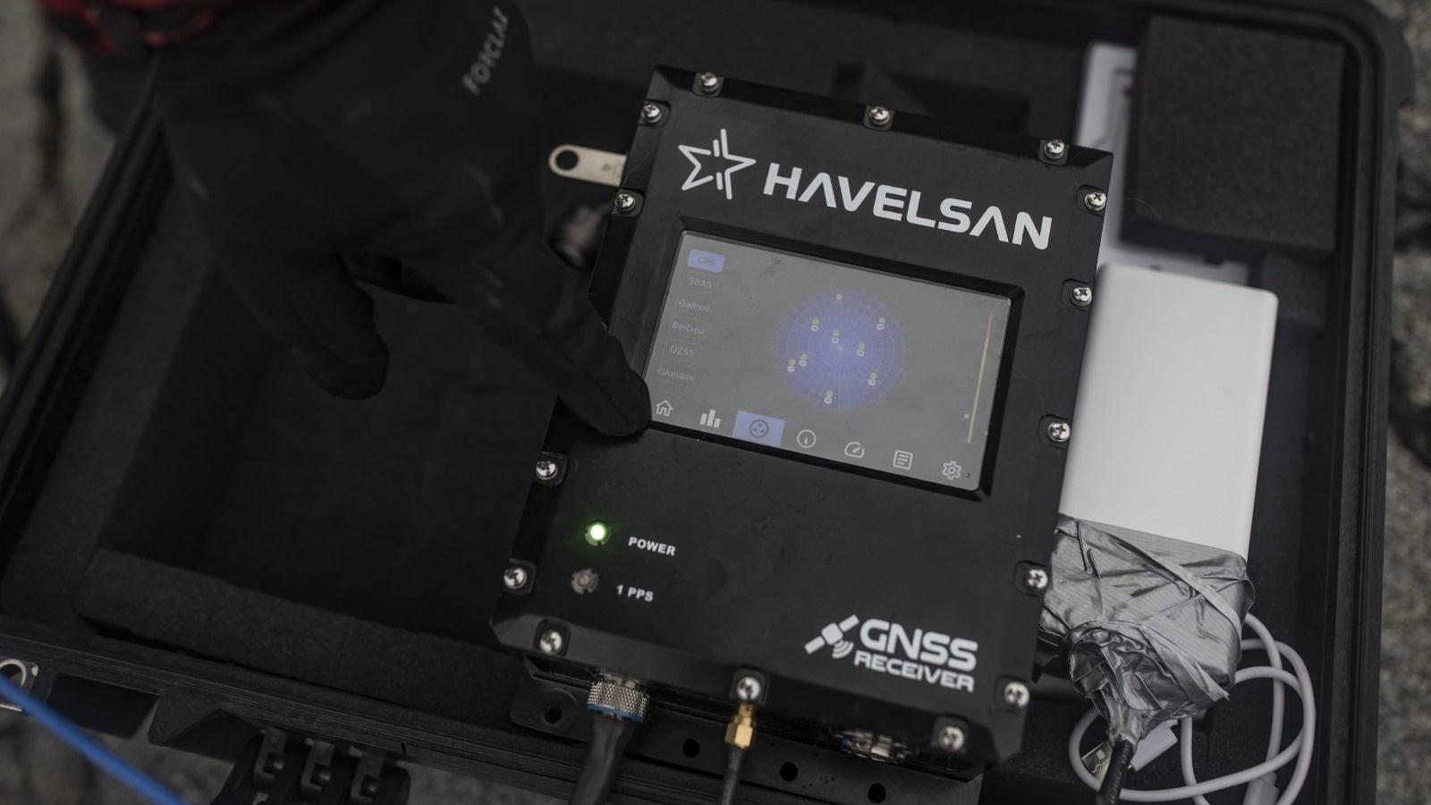
HAVELSAN GNSS
The GNSS receiver, which HAVELSAN has been working on for a while, emerged as a result of the need to use an independent navigation system on ships. The device was first used in the 6th National Antarctic Science Expedition.
HAVELSAN GNSS does not need to be externally connected to a fixed place for operation and can also be powered by a portable powerbank.
HAVELSAN GNSS can perform position calculations and provide global coverage by using different global positioning satellite systems such as GPS, Galileo, BeiDou, GLONASS, QZSS.
HAVELSAN GNSS, which offers uninterrupted working performance with real-time location, speed and time information, will be ready for use on many ships after its pole mission.


